
GIS Applications and Map Integration
What is Geographic Information Systems (GIS)?
A geographic information system is an integrated computer hardware and software that stores, manages, analyzes, organizes, outputs and visualizes geographic data.
It's not just about generating data; it's also about making it usable and integrating it into decision-making processes. GIS applications and map integration enable field operations to be conducted in integration with headquarters.
What to Do with GIS?
Data Management
With GIS, geographic data is collected, organized and made available for analysis.
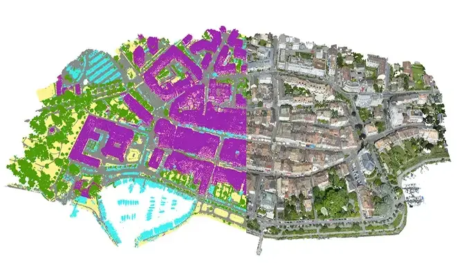
Map Visualization
Complex data can be visualized on a map to make it easier to understand and share.
Location Analysis
Spatial relationships such as settlement, transportation or natural resources are analyzed in detail.
Project Directions
Decision-making processes are supported in infrastructure, urban planning and engineering projects.
Risk Modeling
Risk maps and scenarios are prepared against disasters such as earthquakes, floods and fires.
Which GIS Software Do We Use?


ArcGIS Mapper is a geographic information system (GIS) for visualizing data. It displays data on a map, making it easier to understand geographic patterns, relationships, and trends.
Pathfinding, proximity searches, and network monitoring
Collect, organize and update data in real time or offline
Integrating location intelligence into workflows
Monitor field changes with real-time data flow


Why is GIS Used?
Location and Route Plan
GIS helps determine the most appropriate routes in transportation and logistics, saving time and cost.

Infrastructure Planning
GIS is a powerful tool that supports decision-making processes in the management of water, electricity, transportation and communication networks.

Resource and Disaster Management
GIS provides critical data for the sustainable use of natural resources and rapid response in disaster situations.

Secure Data Storage
GIS platforms allow geographic data to be stored securely and organized and easily shared when necessary.

Environmental and Agricultural Projects
GIS is used to improve the productivity of agricultural lands, optimize irrigation plans, and map disease risks.

Security and Public Safety
GIS is used to analyze crime densities, respond quickly to emergencies, and increase city safety.


Add Layer to Your Projects with GIS • Increase Your Efficiency • Strengthen Your Decision Making Processes • Manage Your Resources Effectively
Let's Shape Your Project Together
Weekdays: 9:00 - 18:00
Weekend: 13:00-17:00