

Cartographero Cartography
Equipment
 |  |  |  |
|---|
DJI Matrice 4E, one of the latest technologies in its field, is a drone with four flight modes, five light systems and a range of 25 kilometers.
5-way oblique and 3-way orthographic shooting mode, 0.5-second interval shooting photogrammetry
Up to 49 minutes of uninterrupted operation AI-supported data processing
Smart 3D Shooting Mode LiDAR and Thermal imaging
DJI Terra, Pix4D and DroneDeploy compatibility Precise mapping with RTK technology


Softwares


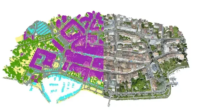
ArcGIS Mapper is a geographic information system (GIS) for visualizing data. It displays data on a map, making it easier to understand geographic patterns, relationships, and trends.
Pathfinding, proximity searches, and network monitoring
Collect, organize and update data in real time or offline
Integrating location intelligence into workflows
Monitor field changes with real-time data flow


Camera System
Sony A7r5 Camera
Sony 24-70mm f2.8 GMII
Neewer Flash
Hohem iSteady M7 Gimbal
DJI Mic2 Microphone
Various Lightings
Let's Shape Your Project Together

Weekdays: 9:00 - 18:00
Weekend: 13:00-17:00


