top of page
cappadocia
map application

Quality is at the forefront

Quality is at the forefront

business intelligence
web map - live map
phone map application
what is total station

Quality is at the forefront

solution icon

Quality is at the forefront

We offer practical and creative solutions to suit your needs. We ensure that you get the most accurate result in every project.

user symbol

Quality is at the forefront

We design our services with the user's expectations in mind. It is our priority to provide an easy and enjoyable experience.

collaboration symbol

Quality is at the forefront

We foster efficient collaboration environments built on open communication. Accurate information sharing with our team and stakeholders is always our priority.

cloud icon

Quality is at the forefront

We produce reliable solutions with modern technologies and high quality standards. We make a difference with constant innovation and development.

About Cartographero

Cartographero believes that maps are not just vehicles that show positions, but digital narratives that record the memory of space. For us, each project is the way geography tells its own story.

We develop UAV-based mapping, precision GNSS measurements, thematic analysis and web-based CBS solutions. Not only do we collect data, we translate it into strategic insights that drive decision processes.

We are positioned as a strategic solution partner in the field of spatial technologies in a wide range from public institutions to the private sector.

For us, every map is the beginning of a vision, not a job, a way to see and understand the world better.

drone şehir haritası

Quality is at the forefront

GIS layers

Visualizing New Stories

Every map we create is equivalent to a new story, we act with the motivation to see the world again.

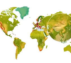
world map example

Showing the World Clearer

By making sense of data and space, we turn complexity into clarity and look for precise results.

what is GIS

Give Inspiration

With our innovative solutions and approaches, we transcend borders and become the inspiration for new ideas.

smart city projects - urban planning

Combining the Past and the Future

Using old data and existing knowledge, we make it easier for you to better understand the present and shape the future.

ortofoto haritas�ı

We Read the Data of Time

We turn every coordinate into a prediction, every data point into a strategy.

As we map today's world with high accuracy, we generate data that shapes the cities, ecosystems and decision processes of the future.

bottom of page