


Oct 7
We've all seen strange devices when passing a construction site, but perhaps the strangest is the tachometer. With its three legs and camera-like head on top, we've always wondered what it was. This technology, useful for general surveying, is often a tool that surveyors always have in their pockets. So, do you know what a tachometer is? If so, you're in the right place, because here's information about the tachometer, which you won't find anywhere else!
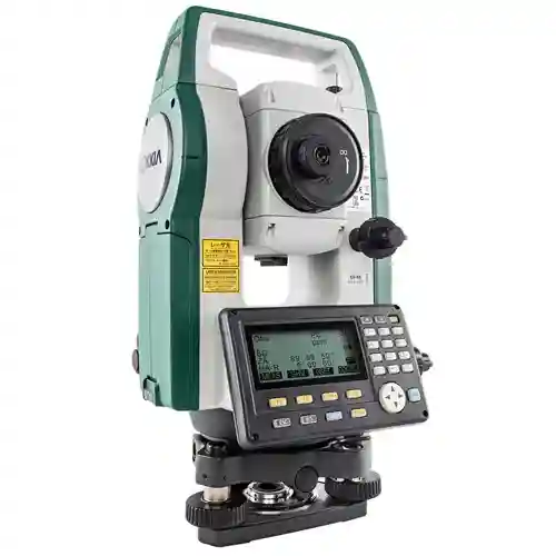
The tachymeter , also known as the tachymeter , is a classic measuring instrument used in land surveying . Its primary function is to measure horizontal and vertical angles between points on the ground and to calculate distances based on these angles . It has been used as a standard measuring tool in surveying, engineering, and construction projects for many years.
When most people hear the word tachymeter today, they think of the modern total station (electronic tachymeter) . This is because a total station performs the same functions as a tachymeter with much greater precision and speed, thanks to the electronic distance meter (EDM) and computer support.

A tachymeter is used to provide accurate coordinate and location data in surveying and construction projects by determining angles and distances between points in land surveys . The device precisely measures horizontal and vertical angles and, thanks to its optical system, quickly and accurately calculates the distance between two points. The measured data allows the determination of the X, Y, and Z coordinates of points on the field, making it useful for applications such as map production , cadastral surveys , or field translation of projects . The tachymeter also helps create digital terrain models by measuring the land surface and accurately marking building corners, road axes, or infrastructure points in the field. Its modern electronic counterpart, a total station , performs the same operations much faster and with higher precision.

The answer to the question of how to measure with a tachometer begins with correctly setting up the device and precisely identifying points on the field. First, the tachometer is secured to a tripod and leveled with leveling screws. Then, the height of the device and the height of the opposing prism are measured and entered into the device. After aiming at a known reference point, the prism is placed at the point to be measured and the device is aimed. The device measures the distance from the horizontal and vertical angles and calculates the X, Y, and Z coordinates of that point. During measurement, the data is stored in memory and transferred to the computer, enabling map creation and transfer of project coordinates to the field.
Tachymeters are used by civil engineers, surveyors, geodeticians, and land surveying teams seeking precise land survey data . Additionally, the question of who uses tachymeters can also be answered by professionals who create digital models and maps.

A tachometer is used when precise and reliable land measurements are required. The device is particularly useful for providing accurate coordinate and distance data in the field, particularly for projects such as map production , cadastral surveys, construction projects , road and bridge construction, and dam or infrastructure projects . Furthermore, a tachometer is an indispensable tool when it comes to creating digital terrain models by measuring the land surface or transferring project points to the field.
There are generally four different types of tachometers: manual, robotic, reflectorless, and prism-based . Each has different uses and offers practical applications depending on the specialty.

Manually operated by one or two people, they require manual aiming and adjustments. They are cost-effective and suitable for small-scale projects, but are slower and prone to human error.

These stations are automated and can be operated remotely by a single person using a motorized system. They feature features such as automatic target tracking and real-time data transmission. They are ideal for large-scale projects requiring accuracy and speed.

Using laser technology, it measures distances directly from surfaces without the need for a prism reflector. It's useful in inaccessible or hazardous locations. Depending on conditions, it can measure distances from approximately 400 to 2000 meters.

Requiring a reflector prism to measure distances, they offer long range and high precision, and are often used in geodetic surveys and large infrastructure projects. They can measure distances of up to 5 km.
How to set up a tachometer in its simplest form:
Prepare your equipment: Your total station, tripod, tribrach (mounting base), survey marks, and controller.
Choose a good spot: This spot should be stable and flat, with nothing obstructing the view of the area to be measured.
Mark a control point: Place a sturdy stake or nail in the ground to use as a reference point.
Set up the tripod: Spread the legs evenly over the control point and adjust the height to match your chest level.
Mount the total station: Securely fasten the instrument to the tripod using the tribrach.
Level the instrument: Ensure that the total station with the built-in spirit level and optical plummet is completely level and aligned with the control point.
Turn on and configure the device: Turn on the total station and controller, enter project information, and verify that levels and laser guidance are correct.
Calibrate and test: Before starting the measurement, check accuracy by measuring angles and distances to known points.
Of course, the tachometer has many uses, as it's a tool that can easily measure angles and distances. While its place is particularly prominent in surveying and construction, it also has a place in infrastructure monitoring , archaeological site applications, mining, and geographic information systems . Let's now explore the uses of tachometers, one by one.
Tachymeters are essential for accurately marking property boundaries and creating land maps . They help reduce legal disputes and ensure precise land division in urban developments and rural areas.

In construction, total stations assist with the layout and alignment of building foundations, roads, and utilities. They ensure that structures are built to design specifications, improving accuracy, reducing material waste, and expediting project completion.
Monitors slips and deformations in bridges, dams, towers and other structures to monitor safety and schedule timely repairs.
Total stations are used to map natural landscapes, agricultural areas , elevations, flood plains and environmental conditions, helping to plan drainage, conservation and ecological projects.

They create detailed 3D models for conservation and research, allowing for precise documentation of archaeological sites.
It contributes data for Geographic Information Systems (GIS) and helps create detailed 3D terrain models for planning, resource management and visualization.
It is used to measure land size, volumes and infrastructure layout in mining and commercial industries.
Scientists use tachometers to track weather balloons and measure atmospheric conditions for weather forecasting and environmental studies.
Theodolite (Left) and Tachymeter (Right)
Feature | Theodolite | Tachymeter |
Measurement | Measures only horizontal and vertical angles | Measures angles and distances (with Electronic Distance Measurement - EDM) |
Data Processing | Data is recorded and calculated manually | Processing is done with electronic data recording and embedded software |
Use | Usually requires two people (one to aim, the other to read) | Can be operated by a single person |
Ease of Use | Simpler and cheaper | More complex but more efficient |
Applications | Suitable for simple angle measurements | Ideal for extensive land surveying, mapping and surveying work |
Technology | Analog or basic electronics | Advanced with built-in computer for calculations |
Both theodolites and tachometers have these three main axes for measuring horizontal and vertical angles. A tachometer integrates these angular measurements as well as distance measurement, but relies on the same basic axis movements for aiming and angle acquisition. Both theodolites and tachometers generally have three main types of axes:
Vertical Axis: Allows the device to rotate left to right to measure horizontal angles.
Horizontal Axis (or Trunnion Axis): Allows the telescope to move up and down for vertical angle measurements.
Line of Sight Axis (or Telescope Axis): This is the axis around which the telescope itself rotates or aims to view a target.
These three axes are fundamental to operation. Some advanced tachometers may have additional internal sensors or components, but these three remain the basic mechanical axes.
The English term for tachymeter is "total station," and it refers to the electronic tachymeter used in modern surveying and construction projects. While the traditional tachymeter is an optical device capable only of measuring angles, the total station can measure both angles and distances , electronically record measurement data, and perform coordinate calculations . Therefore, in land surveying, cadastral surveys , and construction applications, the term "tachymeter" is often used to refer to a total station, and professionals often recognize the device by this English name.


Comments