top of page
All Blogs
Search


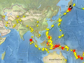
Seismic Prediction with Data: What is an Earthquake Map?
Earthquakes have always been a topic of discussion throughout history due to their sudden development and destructiveness. As long as the Earth's lithosphere, or upper crust, continues to move, they will continue to occur, and there is no technology that can prevent these disasters. Therefore, it is up to us humans to act based on data and take precautions. Thanks to geographic information systems (GIS), we can develop applications such as fault line movement and recent earth
Işık Arda Yardımsever
Oct 26, 2025


What is Radar, Its History and How Does It Work?
The history of radar technology, spanning from the past to the present, has been shaped by the collaborative efforts of scientists and has reached its current level of advancement through numerous innovations developed in various fields. Radars play vital roles in military defense systems, civil aviation, and meteorology, becoming the cornerstone of safe transportation, effective weather control, and accurate weather forecasts. Thanks to technological advancements, radars co
Furkan Sağlam
Oct 8, 2025


Historical Discoveries and the Development of Cartography
The history of cartography dates back thousands of years BC and continues to evolve today. When researching any topic, looking at historical records should always be your first step. With this in mind, we decided to create a comprehensive content. Contents The Renaissance's Impact on Discoveries First Step to America: The Truth Behind Christopher Columbus's Voyage How One Voyage Changed the World: Vasco da Gama and the Spice Route A 500-Year-Old Riddle: The Piri Reis Map and
Denizcan Kapıcıoğlu
Oct 8, 2025


Before the Flames Arrive: Satellite Technologies That Provide Fire Warning
We always talk about forest fires afterward: how many hectares were burned, how many days did it last, how many people intervened? But the real question often lingers: Could we have foreseen this? In this article, we look not at the past, but at the possibilities. Thanks to two recent studies based on satellite data, we'll examine what nature tells us about where and when fires might break out. So, it's a little science, a little data, and a little effort to understand nature
Gülüzar Yiğit
Oct 7, 2025


The Soil is Cracking: Satellite Drought Maps
Drought doesn't begin overnight. First, rainfall decreases, then humidity decreases, and plants lose their color. The key to understanding this silent progression is not just looking at the ground, but looking from above. Satellites have been tracking these changes for years. In this article, I'll explain how atmospheric irregularities are mapped, what data helps us predict soil drying, and why we should think of drought as a matter of "foreknowledge." What Does Drought Tell
Gülüzar Yiğit
Oct 7, 2025


Photogrammetry and Hyperspectral: Data Mining from Imagery
An unmanned aerial vehicle (UAV) flies over a field or forest. Its camera takes hundreds of high-resolution photos, but it also captures colors in invisible wavelengths. So, what can such supervision reveal? For example, information such as chemical changes in plant leaves, soil moisture, or the material of a building's roof can only be revealed by processing photogrammetric (3D modeling) and hyperspectral (multispectral color analysis) data together. In this article, we'
Gökçe Bal
Oct 7, 2025


What is Remote Sensing? Fundamentals and Applications
Today, remote sensing is one of the most effective tools for observing and understanding the world. Often without fieldwork, imagery obtained from above or from orbit allows us to quickly collect data across vast areas. This data can be processed and used in a wide range of fields, from engineering to environmental management. In this article, we will explore the fundamental definition of remote sensing, image processing, and classification methods. We will also examine its a
Gökçe Bal
Oct 7, 2025


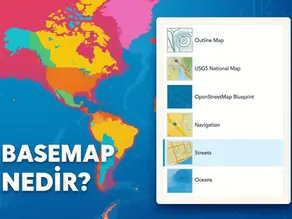
What is a Basemap?
Maps are like the scenes of a story, but the setting that sets the stage is actually the basemap . The basemap is the background map layer upon which other data layers are placed. This layer helps us understand where we are and provides visual context. As defined by Esri's GIS glossary, the basemap is "the foundation layer of a map's visual and geographic context." In other words, it serves as a solid foundation upon which information like streets, terrain, or infrastructure
Gökçe Bal
Oct 7, 2025


What is NDVI (Normalized Vegetation Index)?
Simply seeing how much "green" a field actually is isn't always enough. Especially when we're talking about large areas, some technology is essential. Did you know we can measure the health of plants remotely, and even numerically? NDVI does exactly that. It helps us understand the condition of soil, fields, and forests by looking at satellite imagery. Without further ado, let's take a detailed look at what NDVI is and where it's used. Contents Interpretation of NDVI Values N
Gökçe Bal
Oct 7, 2025


Map Projection Methods: Plaining the World
Carl Gauss long ago demonstrated the impossibility of transferring the world onto flat paper . Just as it's impossible to peel an orange and make it perfectly flat, creating a map of the Earth's surface inevitably distorts some of it. Projections are mathematical methods that show us how to manage these distortions. When deciding which feature to preserve, we ask ourselves: shape, area, or distance. Ultimately, every projection perfectly preserves a limited feature, while o
Gökçe Bal
Oct 7, 2025


What Are the Types of Maps? Everything You Didn't Know!
A wide variety of map types have been developed to illustrate different aspects of geography. Maps are data tools that transform from mere visuals into narratives. There are four main axes for distinguishing maps: scale , content/subject , production technique , and intended use . Whether a map is shot close-up to see small details or a distance away to see the global picture, scale determines this. The attribute emphasized in the map (physical structure, political borde
Gökçe Bal
Oct 7, 2025


What is Surface Modeling? TIN, Grid, and 3D Mesh Comparison
The Earth's crust isn't just a flat plate; it's a gigantic labyrinth filled with fractures, potholes, and high peaks. So, how can we bring this complex labyrinth to our computer screen? In the world of cartography and GIS (Geographic Information Systems), surface modeling is the answer to this question. Every point on Earth has an elevation value, and the "digital surface" formed by combining these values can be represented using various methods. This article will examine th
Gökçe Bal
Oct 7, 2025


Digital Cartography: What are CAD and GIS Applications?
Once upon a time, maps were shaped by a sheet of paper on a brown table, a pencil at the edge, and a thoughtful engineer at the helm. Today, this scene has become digital. Digital maps displayed on computer screens are no longer just directions; they have become intelligent systems that encode the future of cities, disaster risks, and infrastructure. So how are these digital maps produced? The answer lies in the seamless integration of multiple technologies: CAD and GIS softw
Gökçe Bal
Oct 7, 2025


Digital Land Registry: Cadastre in Turkey
Today, more than 58 million parcels in Turkey can be searched digitally in seconds. How is this possible ? The answer lies in the years-old databases and modern technologies of the General Directorate of Land Registry and Cadastre (TKGM) in Turkey. Since 1924, cadastral engineers have completed the measurement of approximately 58.5 million parcels, creating the country's two-dimensional cadastre. Managing this vast real estate stock today requires not only traditional mapp
Gökçe Bal
Oct 7, 2025


Reading the Landforms: What is a Topographic Map?
The Earth's surface is shaped by tectonic movements and various other external factors. This results in mountains, rivers, valleys, and other rugged terrain. In areas like construction sites or logistics, looking at a 2D map is inefficient because factors like terrain slope and elevation are inaccessible. Therefore, topographic maps are used. So, what is a topographic map, how is it made, and in what areas is it used? The answers to all these questions are here. Contents What
Gökçe Bal
Oct 7, 2025


From Aerial Imagery to Scale Maps: What is an Orthophoto?
You're holding a photograph taken from the sky; can this image serve as a measured map ? This might seem like a negative idea to many. However, orthophoto technology achieves precisely this impossible. There's a photograph, and every point in this scene has been meticulously mapped to its real-world coordinates. Orthophotos represent a measurable reality . These images, at the heart of modern cartography, provide critical data layers in many areas, from land and sea to airp
Gökçe Bal
Oct 7, 2025


Satellite Observation and Remote Sensing Systems in Turkey
Satellites silently orbiting in space, like vast "observation towers," constantly take photographs from a distance. Farmlands, forests, cities, and disaster areas around the world are becoming visible thanks to these devices, the eyes of space, even if they don't always utilize light. So, is this bold Sentinel or Landsat ? Or why are other satellite systems like SPOT , Pleiades , Göktürk , and WorldView preferred? In the rest of this article, we'll answer these question
Gökçe Bal
Oct 7, 2025


GNSS vs GPS: Satellite-Based Positioning Systems
When we open a map on our smartphone, our location is actually determined by the synchronized operation of dozens of satellites in the sky. So, what's behind the "GPS" we see on that screen? GPS (Global Positioning System) isn't just a standalone system these days. We're in the age of GNSS (Global Navigation Satellite Systems). GNSS includes multiple satellite constellations, including America's GPS, Russia's GLONASS, Europe's Galileo, and China's BeiDou, in addition to Ame
Gökçe Bal
Oct 7, 2025


Map-Supported Decision Systems in Disaster Management
Climate change is infiltrating our lives rapidly and effectively. Droughts, floods, wildfires... Amidst this chaos, we have a powerful compass: Geographic Information Systems (GIS) and remote sensing technologies. With these technologies, we can monitor climate risks virtually live—pixel by pixel. Modern maps don't just show rivers and mountains; they also reveal water scarcity, agricultural productivity, and climate stress. Thanks to satellite imagery and sensor data, maps c
Gökçe Bal
Oct 7, 2025


Online Map Services: ArcGIS, GEE, and Mapbox Comparison
Today, maps are more than just a guide. We can view weather conditions, traffic flow, disaster risks, and even social media activity in real-time. Thanks to modern online mapping services, this dynamic information gains meaning through constantly updated map layers. So, how do these systems work, and why should we choose one when developing a project? In this article, I'll cover the basic principles of online mapping services, the installation and integration steps for these
Gökçe Bal
Oct 7, 2025
bottom of page
